Winona Lake is a 571-acre natural lake in Kosciusko County, Indiana, with a free public boat ramp on its northwest side, a documented fish species list, and a hole that reaches 79 feet. That acreage is the Lilly Center for Lakes & Streams' figure. The Indiana DNR's depth map prints 562 acres, and this site's own shoreline tracing lands near 569, because different mapping methods draw the water's edge in slightly different places. In passing conversation, about 570 acres is close enough. The competing figures are lined up, each with its source, in how big is Winona Lake?
Everything in this guide traces to the Indiana DNR or to the Lilly Center at Grace College, which monitors the lake. The sources do not say which cove produces in May or what the bluegill are hitting this week, so this guide does not either. They do cover, in useful detail, the access, the species, the underwater structure, and the rules.
Getting on the water
The Winona Lake boat ramp is the DNR public access site at Kiwanis Park, a City of Warsaw park entered off Hillside Drive, on a channel that opens into the northwest side of the lake. The DNR's fish management report places the access at the park's northwest corner, and the DNR's access records list a concrete ramp, a courtesy dock, a fishing pier, a parking lot, and no fee. Hours, parking, the rental launches on the east shore, and the fees and plant rules that apply at the ramp are collected in the public access guide. Once you launch, remember that Indiana law holds motorboats to idle speed within 200 feet of the shoreline, so the run out from the ramp starts slow; our boating lap page maps that 200-foot line all the way around the lake.
Before a first trip, pull up the DNR's Where to Fish interactive map. It plots public access sites statewide, along with fish consumption advisories and low-head dam warnings, and it is the right place to confirm the details of the Winona site, since the DNR notes that its plotted locations are approximate. Our maps page gathers the lake's maps in one place.
For shore fishing, or for a family outing where fishing shares the day with swimming, Limitless Park on Park Avenue is the town's lakefront park. Its listing describes a beach with a designated swimming area, a splash pad, a playground, and hourly or daily rentals of canoes, kayaks, paddle boats, and paddleboards, which means a young angler can get on the water without a boat or a trailer. The town's parks page has contact details.
What swims here
Six fish species are documented for Winona Lake. The Lilly Center's lake profile lists bluegill, channel catfish, largemouth bass, longear sunfish, white bass, and yellow perch as the lake's notable species, over a bottom of sand, gravel, muck, and marl. That list is the closest thing the lake has to an official roster, and I treat it as the documented answer to what swims here.
The panfish end of that roster is the easy entry point. Under Indiana's statewide rules, bluegill carry no bag limit and no size limit, and yellow perch carry none either, which makes both a forgiving target for kids fishing off a rented paddle boat or the park shoreline.
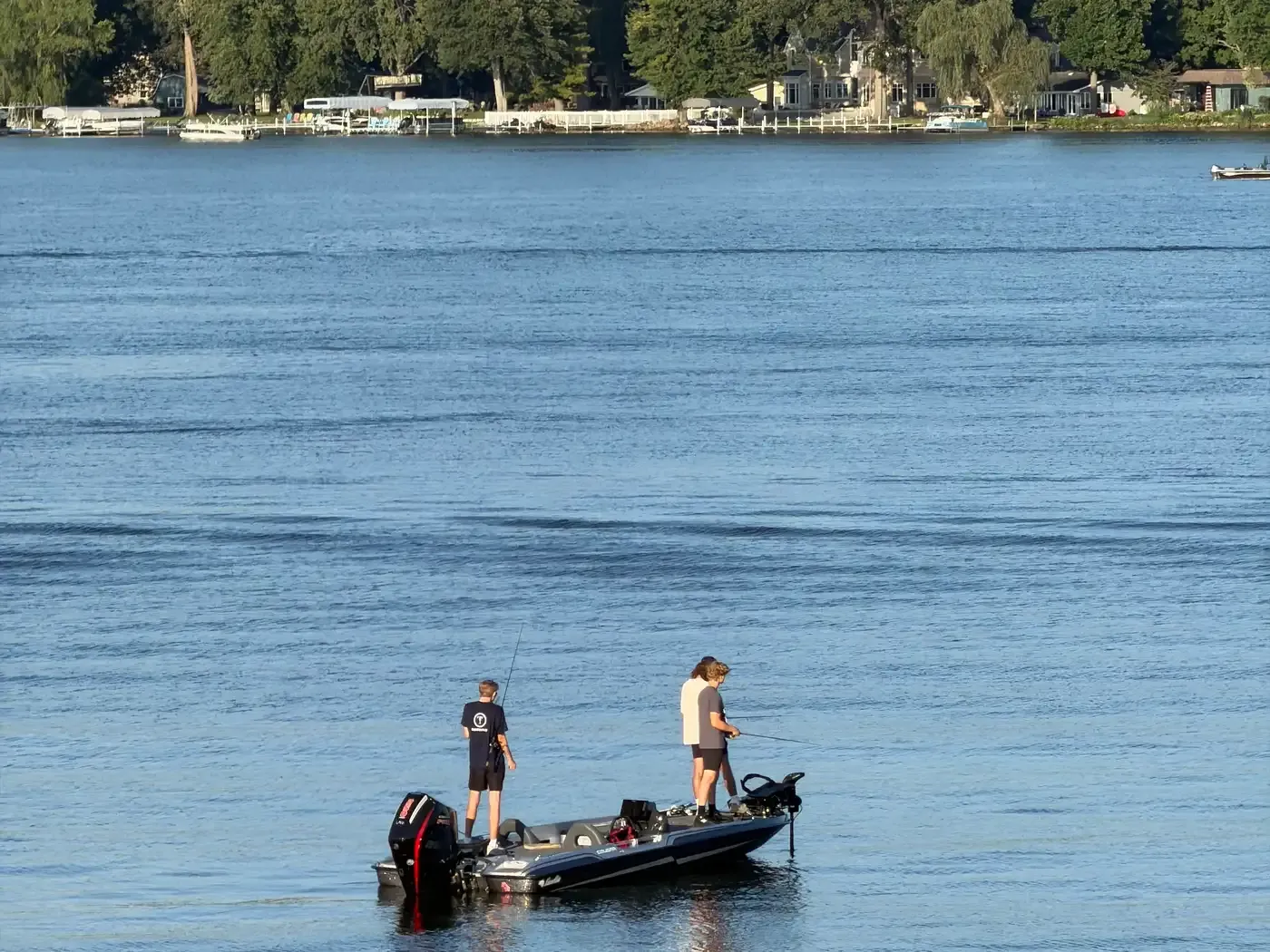
Bass fishing on Winona Lake runs under the statewide lake rules as well. The DNR keeps a list of waters with special bass regulations, and Winona is not on it, so the standard 14-inch minimum and five-fish combined bag apply here just as they do on most Indiana lakes.
Walleye and northern pike deserve a mention even though the Lilly profile does not list them, because the state rules that apply at Winona cover both. Indiana splits its walleye size limit at State Road 26, and Winona lies north of that line, so the 16-inch walleye minimum is the one that counts on this lake. Northern pike carry a statewide 24-inch minimum. Both appear in the regulations table below; I present the six Lilly species as the documented list and leave it there.
Reading the water
The definitive picture of the bottom is the DNR's August 2017 bathymetric survey, a sonar map produced with BioBase by C-MAP and published with permission to reprint with credit to the IDNR. Its title block reads 562 acres, contours every 10 feet, and a maximum depth of 79 feet. The 30-foot average depth you will see quoted for the lake comes from the Lilly Center's profile, not from the map itself.
A single main basin holds the deep water, down to the 79-foot hole. The west side drops off fast. The northwest arm, where Eagle Creek leaves the lake, runs mostly under 10 feet, with one pocket past 20. South of the deep basin, a mid-lake shoal rises from water more than 20 feet deep to less than 10 before dropping away again, and a second, smaller shoal sits east of it. Deep water makes up a large share of the lake: two independent tracings on this site put the area deeper than 20 feet at 316 and 319 acres, about a one percent difference between methods.
We rebuilt the survey as an interactive map at /depth, and that page also states the fishing consequence I will repeat here: fish hold on the drop-offs, and the 10-to-30-foot contour steps on the west and east sides, together with the shoal edges, give walleye, bass, and perch their structure. That is as far as the published record goes: no source documents named productive spots on Winona, and the contours are public for anyone to read.
Rules and licenses for 2026-27
Winona is a public water, so most anglers need an Indiana fishing license; anyone under 18 is exempt. A resident annual license costs $23, a nonresident annual $60, one-day licenses run $10 for residents and $15 for nonresidents, and residents 64 and older qualify for a $3 annual. Licenses are sold through the state's gooutdoorsin.com portal.
The limits below are the statewide lake rules from the 2026-27 Indiana Fishing Regulations Guide, which the DNR updated July 21, 2026. The guide describes itself as a summary, with Indiana Code and 312 IAC controlling if anything conflicts. Read it on the DNR's fishing guide and regulations page or in the eRegulations digital edition.
Rules checked August 19, 2026, from the 2026-27 Indiana Fishing Regulations Guide. Winona Lake is not on the DNR's special-bass-regulation waters list, so statewide lake rules apply. Limits change between guide editions; verify against the DNR's current guide before fishing.
| Species | Daily limit | Size limit |
|---|---|---|
| Largemouth, smallmouth, and spotted bass (lakes) | 5 in any combination | 14-inch minimum |
| Bluegill | No limit | No size limit |
| Redear sunfish | 25 | None listed |
| Crappie | 25 | None listed |
| Channel catfish (lakes) | 10 | No minimum; at most one 28 inches or longer |
| Yellow perch | No limit | No size limit |
| Walleye | 6, aggregate with sauger and saugeye | 16-inch minimum north of State Road 26 (includes Winona) |
| Northern pike | 3 | 24-inch minimum; at most one 30 inches or longer |
How the seasons move the fish
There is no published month-by-month bite calendar for Winona Lake, so I will not offer one. What the sources document is the physics underneath the seasons. In summer the lake stratifies into layers that stop mixing, and the deep water slowly loses dissolved oxygen with no way to replace it until fall turnover stirs the lake back together. The Lilly Center notes that most fish need more than 2.0 mg/L of dissolved oxygen to survive, so late summer squeezes fish out of the deepest water and into the oxygenated band above it, which is one more reason the drop-off structure on the depth map matters in July and August. After turnover, oxygen returns to every depth and the whole basin opens back up. The full cycle is covered in our article on the lake's seasons.
Winter slows everything down. The Lilly Center's page on fish habitat in winter describes bottom water holding around 35°F under the ice while fish enter torpor, a dormancy in which heartbeat, breathing, and muscle activity all drop. Oxygen becomes the limiting budget: decomposing plants consume it all winter, clear ice passes enough sunlight for plants to add some back, and heavy snow cover can shut that resupply off. For anyone tempted onto the ice, the Lilly Center's baseline is a minimum of four inches of ice, a life jacket, and a companion, never fishing alone. Four inches is a minimum. Thickness varies across a single lake, and no ice is guaranteed safe.
Take care of the fishery
Leave the ramp cleaner than you found it. The DNR's aquatic invasive species guidance asks every boater to clean, drain, and dry: remove all plants, mud, and debris from the boat and trailer, drain every bit of water (bilge, live wells, and ballast, with the plug pulled) before leaving the access point, and let the boat dry about five days before launching somewhere else. Eurasian watermilfoil alone costs Indiana about $1 million a year to control in public waters, and boat ramps are how it travels between lakes.
If you plan to eat your catch, check the state's guidance first. The Indiana Department of Health, working with IDEM and the DNR, publishes waterbody-specific fish consumption guidelines and an interactive map with the current listings. Consumption advisories are health guidance, separate from the fishing rules above. Our article on eating fish from Winona Lake walks through how to read the map and what it currently says.
Check conditions first
Wind and weather decide whether a 570-acre lake is comfortable in a small boat, so check before you hitch up. The Lake Today page shows current conditions, a five-day forecast, and a watersports score for the lake, and weather.winonalake.org carries a live hourly forecast.
Before you go
- License: $23 resident annual at gooutdoorsin.com; anglers under 18 are exempt.
- Ramp: the DNR public access site at Kiwanis Park, off Hillside Drive on the northwest side; details in the public access guide, and confirm on the Where to Fish map.
- Structure: study the contours at /depth; the drop-offs on the west and east sides and the shoal edges are where the survey and the site put the fish-holding structure.
- Rules: the table above reflects the 2026-27 guide as of August 19, 2026; the current edition always lives on the DNR's regulations page.
- On the water: idle speed within 200 feet of shore under IC 14-15-3-17; the boating lap page shows how that zone wraps the lake.
- On the way out: clean, drain, and dry before the next lake.
Support the organizations in this article
The monitoring and research behind this article are the work of the Lilly Center for Lakes & Streams at Grace College, which accepts gifts toward its research and education.
More about the local organizations, and other ways to help, is on the stewardship page.
Sources
- Indiana DNR: Fishing Guide and Regulations: the 2026-27 guide, license fees, and statewide bag and size limits. Checked August 17, 2026.
- eRegulations: Indiana Fishing: digital edition of the 2026-27 regulations guide. Checked August 17, 2026.
- Indiana DNR: Where to Fish interactive map: public access site locations, consumption advisories, and low-head dam warnings. Checked August 17, 2026.
- Indiana DNR: Winona Lake bathymetric map, August 2017: the 562-acre title block, 10-foot contours, and 79-foot maximum depth. Checked August 17, 2026.
- Lilly Center for Lakes & Streams: Winona Lake profile: the 571-acre surface area, species list, bottom composition, and access listing. Checked August 17, 2026.
- Lilly Center: fish and their habitat during winter: torpor, the 2.0 mg/L oxygen floor, and ice safety minimums. Checked August 17, 2026.
- Indiana DNR: aquatic invasive species: clean-drain-dry steps and Eurasian watermilfoil control costs. Checked August 17, 2026.
- Indiana Department of Health: fish consumption advisory: waterbody-specific consumption guidance and the statewide interactive map. Checked August 17, 2026.
- Visit Kosciusko County: Winona Lake park, beach, and splash pad: Limitless Park amenities and rental offerings. Checked August 17, 2026.
- Town of Winona Lake: Parks & Recreation: town park contact information. Checked August 17, 2026.