No organization publishes a single water-quality score for Winona Lake. The lake's condition is tracked through several separate programs: bacteria counts at the beach, algae-toxin tests through the summer, nutrient and clarity measurements summarized once a year, and temperature and oxygen profiles that describe the deep water. Each number comes from a particular group sampling on a set schedule, and each answers a narrower question than "is the lake clean."
If you arrived here with the swimming question, the bacteria section below covers the numbers, and Is Winona Lake safe to swim in? covers the decision.
Looking to test your own well or tap water? That is a different service from anything on this page, which covers the lake itself. In Kosciusko County, the county health department handles well permits and can point you to sampling. The Indiana Department of Health laboratory tests private well samples directly and mails collection containers once an order is placed: bacteria $10, nitrate $10, fluoride $10, and arsenic, lead and copper $20, none of which includes shipping. The state's well water guidance asks for bacteria and nitrate every year, adding fluoride, arsenic, lead and copper every five years or after major well work. Prices checked September 2, 2026.
Who monitors Winona Lake
The most detailed local record comes from the Lilly Center for Lakes & Streams at Grace College. Its research team samples seven public beaches weekly during the summer, Winona Lake Beach among them, and 14 area streams every other week all year round, publishing the results on its E. coli data page. From June through August it also tests weekly for microcystin, a blue-green algae toxin, on its microcystin data page. Once a year it publishes Beneath the Surface, a data summary on the health of 16 Kosciusko County lakes covering clarity, dissolved oxygen, nitrogen and phosphorus, blue-green algae toxins, and E. coli.
The Indiana Department of Environmental Management runs the statewide layer. Its surface-water monitoring program collects water chemistry, E. coli, fish community, macroinvertebrate, aquatic habitat, and algae data on a rotating basin and seasonal schedule, and that data feeds the state's assessments, permits, and public-health advisories. IDEM's own blue-green algae page concentrates its summer sampling on state park swimming areas, and it points readers to the Lilly Center as the monitor for Kosciusko County's all-sport lakes. So the state itself treats the local program as the primary eyes on this lake.
Between sampling dates there is one continuous feed: a public stream monitor on Xylem's HydroSphere platform reports live conditions at the lake's inlet and outlet.
None of these groups decides whether the beach opens. That call belongs to the Town of Winona Lake, working with health officials. In July 2025 the town announced a temporary closure of the beach at Limitless Park after high E. coli counts and reopened it about a day later once health-department test results came back at safe levels. Monitoring data informs those decisions; the announcements come through the town's channels.
The lake the numbers describe
Winona Lake covers 571 acres by the Lilly Center's count, with a maximum depth of 79 feet and an average depth of 30 feet. The DNR's 2017 bathymetric map prints 562 acres for the same lake, and this site's own GIS work lands near 569. The figures differ because the methods differ, a story told in full in the depth map article; "about 570 acres" is close enough for anything on this page.
The water arriving in those 570 acres drains an 18,730-acre watershed, roughly 33 times the lake's surface. It comes in through three inlet ditch systems named on the Lilly Center's profile, Wyland Ditch, Keefer-Evans Ditch, and Peterson Ditch, plus Tennant Ditch on the southeast, which federal hydrography records also trace to the lake. Everything leaves through a single outlet, Eagle Creek. That geometry explains most of what follows: a deep basin that stratifies in summer, fed by a large agricultural and residential watershed that sheds runoff into a handful of channels. The maps page shows the layout.
Bacteria: what the E. coli counts mean
E. coli lives in the digestive tracts of warm-blooded animals, and only a few of its hundreds of varieties can make people sick. Water testing uses it as an indicator: a high count signals that waste from birds, livestock, pets, or people has reached the water, likely carrying other pathogens with it. The Lilly Center's explainer puts the delivery mechanism plainly: "Rain collects E. coli from animal waste and disposes of it in the nearest body of water." For reading the results, its data page states that the EPA's safety threshold is 235 CFU per 100 mL.
E. coli snapshot, October 2026. The Lilly Center's E. coli data page lists Winona Lake Beach at 64.4 CFU per 100 mL, sampled September 2, 2026, down from 161.6 on August 26 and 648.8 on August 12. Inflow streams sampled October 1, 2026: Cherry Creek 1,119.9; Keefer-Evans Ditch 579.4; Peterson Ditch 365.4. Eagle Creek, the lake's outflow, measured 7.5. The page cites an EPA safety threshold of 235 CFU per 100 mL. Beach results update weekly in summer and stream results every other week, so newer numbers supersede these; check the live page before drawing any conclusion. Checked October 5, 2026.
Read those numbers for what they are. A stream count describes the water in that channel on that morning, and it says nothing about the swimming area two miles away; a beach count describes the designated swimming area on its own sampling date. None of them is a whole-lake score, because bacteria wash in from specific places and die off or disperse at different rates around the shoreline. On these dates all three inflows sat above the threshold the Lilly Center cites while the outflow ran far below it, which is a normal spread for a lake with active inlets, and the beach itself went from nearly three times the threshold to under it in two weeks. Counts also move quickly with rain and waterfowl, so a week-old number is history, and a number above the threshold does not close the beach on its own. How that number turns into a beach decision, and what a swimmer should actually do with it, is the subject of Is Winona Lake safe to swim in?
Algae and microcystin: the bloom and the toxin
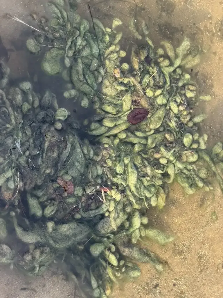
Blue-green algae, more precisely cyanobacteria, grow in every warm, nutrient-rich lake. The health concern comes from toxins that some of them can produce, and the one tested locally is microcystin, which can harm people and pets if it is swallowed or left on skin. Dogs are at particular risk because they drink lake water and lick their fur. The visible bloom and the toxin are separate findings: the Lilly Center's test measures the toxin itself, in parts per billion, and the color of the water is no guide to the result. Its data page states the benchmarks: "IDEM's safety threshold is 8.0 ppb for humans and 0.8 ppb for pets."
Microcystin snapshot, week 16: September 4, 2026, the final round of the season. The Lilly Center's microcystin data page reports none detected at both the Winona Lake open-water site and the beach, as in week 15. On August 21 the open-water site had measured 1.074 ppb, above the 0.8 ppb pet threshold and well below the 8.0 ppb human threshold. Eight of the 23 sites sampled in week 16 carried low detections, the highest 0.404 ppb at Dewart Lake, all under the pet threshold. Weekly results run from June into early September; a comprehensive annual analysis follows in October. Check the live page for current numbers. Checked October 5, 2026.
The detections on neighboring lakes, and Winona's own reading a week earlier, are the reason the testing continues all summer. A clean result is a measurement with a date on it, and conditions that produce toxins can develop as water warms and nutrients accumulate. IDEM announces its own advisories, for the state-managed swimming areas it samples, through signs at the beach and its online dashboard.
Nutrients and sediment: the slow variables
Behind the summer bacteria and algae numbers sits a slower driver: phosphorus. Eroding streambanks shed soil into the inlets; that sediment carries phosphorus bound to it; and phosphorus, once in the lake, feeds algae growth. Nutrient concentrations change over years rather than weeks, which is why they show up in the Lilly Center's annual Beneath the Surface report rather than a weekly feed.
The Watershed Foundation identifies Peterson Ditch, a 13-mile inlet on the lake's southwest side, as the largest contributor of sediment and phosphorus to the lake. Reporting on the July 2026 state LARE grants put an estimate on it: about 74 tons of sediment a year, with a newly funded $100,000 design-build project expected to keep an estimated 68 pounds of phosphorus and 78 pounds of nitrogen out of the water annually. The full story of that inlet, the 2025 streambank study, and the funded fixes is in Why Peterson Ditch matters to Winona Lake.
Clarity, temperature, and oxygen
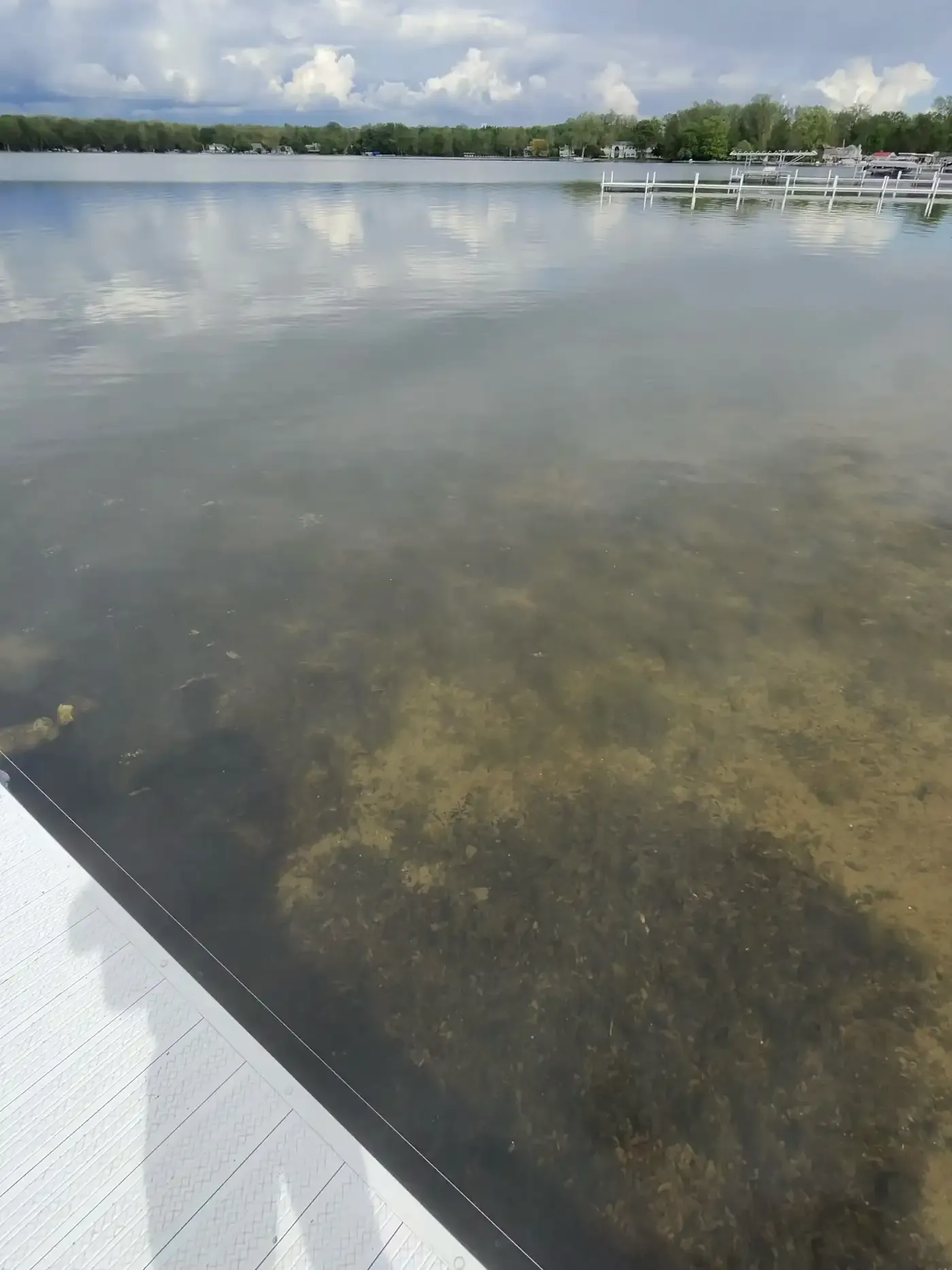
A 79-foot basin is deep enough to stratify. In summer the lake settles into three layers that do not mix: warm water on top, cold water at the bottom, and a transition between them. Twice a year the layers break down and the whole water column mixes, an event called turnover. While the layers hold, oxygen cannot move between them, so the deep water slowly runs down whatever oxygen it had in spring.
The clearest local numbers on this come from the Lilly Center's case study of Lake Wawasee, a nearby Kosciusko County lake, using 2020 data. Those are Wawasee's measurements, not Winona's, but the physics transfers. In that dataset the lake turned over in April and November; surface dissolved oxygen stayed between 8.1 and 14.8 mg/L all year, while the bottom fell as low as 0.1 mg/L during stratification. The Lilly Center notes that most fish need more than 2.0 mg/L of dissolved oxygen to survive, so late summer effectively closes the deepest water to them until turnover reopens it. Clarity, the fourth measurement in this family, is tracked lake by lake in Beneath the Surface. For how the whole annual cycle plays out on Winona, see Winona Lake through the seasons.
What the data cannot tell you
Every number above is a sample taken at one place on one date, for a single parameter. That is how lake monitoring works everywhere, and it sets honest limits on interpretation. A Tuesday beach count describes Tuesday at the beach. Conditions shift with rain, wind, temperature, and waterfowl, so the useful habit is watching the trend across weeks.
Different programs also measure different things in different places. The Lilly Center samples the beach and the streams, IDEM works a rotating statewide schedule, and the HydroSphere sensor watches the inlet and outlet continuously. When two numbers seem to disagree, the explanation is usually site, date, or method, the same reason the lake's published acreage varies by source.
Finally, a measurement and an interpretation are different steps. The lab reported 648.8 CFU per 100 mL at the beach on August 12; calling that unsafe applies a threshold, and the EPA and IDEM thresholds quoted above are where those lines come from. Closing a beach applies a judgment on top of the threshold, and that judgment belongs to the town and health officials, informed by the data. Keeping those steps separate makes every one of these pages easier to read correctly.
What residents can do
The weekly numbers respond, eventually, to what the watershed sends downhill. The Lilly Center's prevention guidance targets the runoff path directly: pick up pet waste, fertilize sparingly and with phosphorus-free fertilizer, and plant native buffer strips at the waterline, where roots filter runoff and hold soil that would otherwise become sediment. Since most of the load arrives through a few ditches, it helps to know where your own yard drains.
The larger fixes run through organizations: the Lilly Center's monitoring, The Watershed Foundation's restoration projects, and the Winona Lake Preservation Association's grant work on Peterson Ditch. The stewardship page collects ways to support each of them.
Before you go: the live sources
Bookmarks for following Winona Lake's water quality as it actually updates:
- Beach and stream bacteria: the Lilly Center's E. coli data page, weekly for beaches in summer and every other week for streams.
- Algae toxin: the microcystin data page, weekly from June through August, with the annual analysis each October.
- Live inlet and outlet conditions: the HydroSphere stream monitor, continuous.
- The annual picture: Beneath the Surface, covering 16 county lakes including Winona.
- State context and advisories: IDEM's surface-water monitoring and blue-green algae pages.
- On this site: Lake Today for current weather and conditions, and the timelapses for what the surface has been doing lately.
Support the organizations in this article
The monitoring and research behind this article are the work of the Lilly Center for Lakes & Streams at Grace College, which accepts gifts toward its research and education. The Watershed Foundation funds and builds the upstream projects that protect the lake; it accepts a one-time donation or a monthly gift.
More about the local organizations, and other ways to help, is on the stewardship page.
Sources
- Lilly Center for Lakes & Streams, Winona Lake profile. Surface area, depths, watershed acreage, and the inlet and outlet list. Checked August 17, 2026.
- Lilly Center E. coli data. The September 2 beach and October 1 stream results, sampling cadence, and the EPA threshold the page cites. Checked October 5, 2026.
- Lilly Center E. coli explainer. What the bacteria indicates, its sources, and prevention guidance. Checked August 17, 2026.
- Lilly Center microcystin data. The August 21 through September 4, 2026 results, the IDEM thresholds, and the testing schedule. Checked October 5, 2026.
- Beneath the Surface. The Lilly Center's annual report on 16 Kosciusko County lakes. Checked October 5, 2026.
- Lilly Center temperature case study. The Lake Wawasee 2020 stratification and dissolved oxygen data. Checked August 17, 2026.
- IDEM surface-water monitoring. The statewide program's parameters and rotating schedule. Checked August 17, 2026.
- IDEM blue-green algae. The state's advisory program and its note on the Lilly Center's role in Kosciusko County. Checked August 17, 2026.
- Indiana DNR 2017 bathymetric map. The 562-acre and 79-foot figures. Checked August 17, 2026.
- The Watershed Foundation, "Protecting Winona Lake: Peterson Ditch Project Underway". The largest-contributor assessment and the 2025 streambank study. Checked August 17, 2026.
- InkFreeNews, "Lake Associations Partner With TWF, Awarded $203,000 In LARE Grants". The sediment and nutrient estimates and the 2026 grant details. Checked August 17, 2026.
- Xylem HydroSphere public site. The live monitor on the lake's inlet and outlet. Checked September 1, 2026.
- WSBT, Limitless Park beach reopening. The July 2025 closure and next-day reopening. Checked August 17, 2026.